
As we face the prospect of delays and possible disruption once work beginis on four-laning County Road 43, it’s worth sparing a thought for those who came before us. When the first surveyors began work in laying out townships in Eastern Ontario (Upper Canada, as it was then), they did something new: they laid out invisible lines across the land, a grid that artificially established the contours of each new township. A nice, neat series of rectangles divided the land into 200-acre lots, each numbered consecutively across each concession. Spaces, 66 feet wide, were left between certain concessions to allow for roads to run throughout the new territory, and responsibility for opening, repairing, and maintaining the roads fell to each lot owner. They had to take care of the road in front of their own property. Each land owner had to perform this Statute Labour on certain days of the year. This requirement continued until the First World War.
The problem arose when many lots were unoccupied and there was no-one to open, much less maintain, that section of road. It was not until the 1830’s that Oxford’s population began to grow and the lots occupied. Anyone who has driven along unpaved roads today can have some idea of what rain, wind, snow and ice can do to the surface. Imagine a world without snow ploughs, graders, or any road repairing machinery. It was often easier to get around in winter, when sleds could glide along surface snow, and even on frozen rivers.
Townships appointed Overseers of Highways for Merrickville, Wolford, Oxford, Montague, and Marlborough from as early as 1802. Once the United Counties Council was established in 1842, moves were made to pave certain roads, officially known as Public Highways, and Surveyors of Highways were appointed. These roads were to be paid for through tolls, and toll booths were set up at places on the road between Prescott and Kemptville in the 1840’s. This road took more than 15 years to complete.
Roads continued to be developed over the next century, as can be seen in a map of Oxford-on-Rideau Township from 1946. Many of the roads we know simply didn’t yet exist in their present lay-out. For example, the section of CR 43 scheduled to be expanded soon was quite different. There was no road between the junction with CR 44 and that with King Street (the Dairy Barn location). And there was no bridge over the South Branch either. To travel from Kemptville to Winchester, travellers had to go along Van Buren to get to the road to Winchester.
Highway 43 west of Kemptville was called Howey Road, and in the 1930’s and 1940’s was described as “a narrow dirt and gravel covered road”. Even as late as that, main roads in the area were impassible in winter. In 1936, an Association was formed to keep the road between Oxford Mills and Kemptville open throughout the winter. They planned to apply for the grant of $4 per mile given by the County for that purpose, as highway 18 was a County road and not the responsibility of the Township.
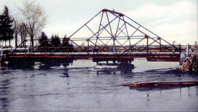
One of the reasons roads could not follow the concession lines, as originally intended, was the absence of bridges crossing the South Branch and smaller streams. This problem was noted as early as 1842. At every one of the Sessions of United Counties Council in these early years, there was a large number of Petitions to be dealt with regarding Roads and Schools. At this first Session, a Petition was received asking for a grant of money to complete the Bridge in the Village of Kemptville.
The petition of Stephen Burritt the younger noted that he had built a bridge over the Rideau River at Burritt’s Rapids, for which he was to receive the sum of £150. Of this amount, he had received the sum of £100 from the Court of Quarter Sessions and prayed that he be paid the balance by the District Council. There was a recommendation at Counties Council in August, 1842, that a bridge be built across the South Branch in Concession 4 between the lot owned by Benjamin Dixon and Clothier, to be 150 ft long, and a budget of £67 currency was approved. The project had been recommended by District Surveyor, and supported by the Committee on Roads and Bridges. The resolution was defeated.
Bridges and roads were expensive to build and maintain; hence the need for toll booths on the major routes. In 1874, the sum of $121.20 was granted by the United Counties, “being one half the balance for the repairs of bridge at Burritt’s Rapids, over and above the grant of $100 previously made by the Council”. The Township of South Gower received a grant in 1876 “to repair the road through the 3rd and 4th concession of the Township of South Gower and Mountain provided the Council of the Corporation of the United Counties of Stormont, Dundas & Glengarry grant a like sum”.
The sum of $200 was granted in aid in repairing the bridge in Kemptville in 1883. In fact the bridges in Kemptville, both at Prescott Street and Bridge Street, were the cause of many conflicts at both County and Village Councils over the years. Roads and bridges were, and continue to be, major infrastructure expenses. But without them, where would we be? Even more important: where would we go?


