
When Oxford-on-Rideau was first surveyed in 1791, a grid pattern was used to divide the land into concessions and lots. That sounds simple, doesn’t it? Ten concessions, each one mile in depth, running south from the Rideau to the border with Edwardsburgh and Augusta Townships, and each concession divided into thirty lots running from west to east: a simple grid. But time was to show that nothing was that simple, and there were numerous attempts to sort out problems which arose for settlers in the decades after that first survey.
One major complication was discovered when new settlers built their homes on their 200-acre lot. In 1821, in response to desperate petitions from settlers in Oxford, an Order-in-Council was passed laying out the main issue for the farmers. It seems that the original survey had stated that the concession road was meant to run along the front of the concession, but settlers had been told to build their homes along the rear instead. As the Order stated:
“It appears from the Quebec Plan of Oxford that the Line of Road was designed to be the front between two Concessions whereas the Surveyor General has Described the Lots as fronting one way so that the Settlers may have been misled to Settle in the rear of their Lots…”
In other words, the houses were a mile away from the road. This same problem arose in South Gower in the 1840’s, and even in 1846, Kemptville resident, Truman Hurd, was asking the Surveyor General’s office: “Are road allowances on the front or base line of concessions in Oxford?”
Roads continued to be a source of confusion through the decades. As the population grew in the late 1820’s, land sales were becoming confused and a proper survey was needed. John West, D.S., produced a map of Oxford, dated 1836, which contains some fascinating details about the road system in Oxford in 1836, though it is oriented to the south, and so is “upside down” compared to normal alignments in later maps.
The hamlet of Kemptville is the only settlement shown, as Oxford Mills had not yet been surveyed, and Burritt’s Rapids seems to have been sited entirely on the north side of the Rideau. However, there is no indication of the bridge and Canal works that existed there at the time. The line of Bolton Road and David Road does appear, following an older Indigenous route lining the St. Lawrence with the Ottawa Rivers. It is marked “Road to Prescott”.
Kemptville is shown as being sited entirely on the north shore of the South Branch River and is laid out in the typical grid pattern of Upper Canada surveys. It is difficult to know if the street layout follows the same layout as in later surveys, but it is likely that it does, in which case, the street closest to the river, and running parallel with it, is Curry Street, but it runs from Lydia Street east to the river. The most northern street is where Oxford Street is today, and the triangle formed by Rideau and Sanders is visible, created by Sanders following the grid pattern, and Rideau running along the lot line between lot 26 and 27 in Oxford. The map shows a plan, rather than, perhaps, the actual existence of streets in 1836.
Clothier Street is shown as continuing past Rideau and out towards where the South Branch turns sharply south above where Oxford Mills would develop. There are only three or four buildings shown west of Rideau, one of which would be St. James Anglican Church, which had been built around 1829. There is a crossroads shown where Hurd and Somerville meet now, and Somerville sweeps around to meet the concession line (now County Road 43) in the middle of lot 21, near where Muldoon and Johnson Roads are today. It then follows the concession line to where Actons Corners is now, where it turns south along the line of Actons Corners Road, as far as the Rideau, where it turns west along what is marked as “River Road”, until it passes the junction with Davis and continues out of the Township. River Road, on this map, only begins at Actons Corners Road and is not shown east of that point.
The line of Prescott Street and County Road 44 is shown running south from the Hamlet, with a dam and bridge shown where it meets the South Branch. Barnes Creek is also shown running south from the river.
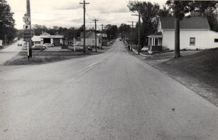
There would be many further changes to the road layout in Oxford in the subsequent years, especially in the hamlets. Settlement didn’t always follow plans. In Oxford Mills, Main Street is not, in fact, the main street. Instead, Water Street became the location for business and residential development. Other surveyed roads were never opened at all, and remained lines on a survey map. And these changes were continuing until quite recently. Between 1930 and 1936, for example, County Road 43 between Barnes Street and the Union Cemetery in Kemptville changed from just a telegraph wire route to an actual road. In the same period, the streets north of Maley and east of James Street were laid out.
The story, as with all history, continues. Development required new roads, alterations to old roads, all of which we have seen in our own day. And then there are bridges…


