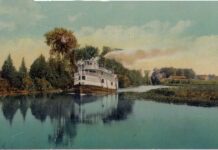
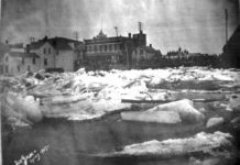
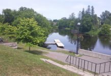
Debate continues about whether a certain stretch of waterway should be called the Kemptville Creek, or the South Branch of the Rideau River. What can be said with some certainty is that the earliest references call it the South Branch, as distinct from the West Branch, or the main Rideau River as we call it today.
Following the takeover by Britain from the French in 1763, the area west of the Ottawa River was closed to European settlement and remained Indian Territory until the arrival of about 3,000 Loyalists refugees following the end of the American war. The Crown negotiated with the Mississauga and Mohawk people to allow these Loyalists to share the land along the north shore of the St. Lawrence, and it became important to have a proper report prepared detailing the nature of the country from a settlement standpoint.
Although it had been used by indigenous people long before Europeans arrived in North America, the first written account of the river dates from 1783, when Lieutenant Gershon French was assigned to survey the Rideau River and the lands around it, to see how suitable it would be for settlement. French was an Assistant Engineer with the Corps of Loyal Rangers, also known as “Jessup’s Corps”, and had served in the American War of Independence from 1776.
The British knew that the Rideau was a familiar route for indigenous travellers to go back and forth between the Ottawa and the St. Lawrence, and so French was ordered to undertake a proper survey of the route, beginning at Carillon on the Ottawa.
On October 5, 1783, he passed what he referred to as “a considerable river”, joining the main Rideau from the east. This was the South Branch, which he notes “leads to a branch of the river De La Petite Nation, from whence the Indians have a communication with Oswegatchie”. French led a party a short distance into what is now North Grenville, where he “found the soil good with a few Pine and Hemlock trees mixed with the timber”.
A line of Townships was established along the St. Lawrence to provide land for the Loyalists, but in 1788 it was decided to grant larger tracts of territory to those militia units who had served with the British against the rebellious Americans. Not enough land was available in the river townships, so it was decided to lay out another line behind them.
On June 4, 1789, the Surveyor General, John Collins, issued instructions of Land Surveyor, John Rankin to, among other work, “2nd – To survey the South side of the Ottawa River, from the part already surveyed to the River Rideau, and forty miles on the South easterly side of the Rideau. 3rd – For the greater caution against errors arising from a mistake of distance, between the St. Lawrence and Ottawa Rivers, two traverse lines are to be run, …[and] from the end of the forty miles on the River Rideau, on the nearest to the St. Lawrence.”
The point on the Rideau forty miles from the Ottawa was the current site of Burritt’s Rapids. The line Rankin drew from there to the St. Lawrence showed that enough land existed to lay out what became the Township of Oxford-on-Rideau in 1791. This work was performed by Jesse Pennoyer, who travelled, with his team, from Brockville to the Forks, where the West Branch and the South Branch of the Rideau River met.
Pennoyer’s account of his travel down the South Branch may sound odd when compared with the state of the river today:
“Saturday 9th April, 1791: Put the provisions and necessaries on to the raft and into the canoes and rowed down the River about four leagues took one of the canoes and three men and went forward on the raft. Met with Mr. DePencier who told me that we were just approaching very bad rapids which he had just passed but had been obliged to unload his raft. I accordingly concluded to do so too but not being able to stop the raft it went down the rapids with all the Provisions on it. But not without imminent danger, however we lost nothing.
Sunday 10th April, 1791: Came on about 8 miles past many dangerous and difficult places without any loss.
Monday 11th : Brought the Raft and provisions round the point and up the West Branch about two miles and encamped.” Note: the West Branch is the main Rideau River. Pennoyer refers to the South Branch when describing his survey work.
An 1836 map of Oxford notes the South Branch, and the only time Kemptville Creek is used on early maps is when later annotations were made. For example, the term is used in a map of 1791, but Kemptville would not exist under that name for another three decades.
It is clear from the historical record that the river was originally known as the South Branch, and was a major stream with a strong current and many falls and rapids, which was why so many mills could be established along its course, giving rise to Bishop’s Mills, Oxford Mills, Perkins Mills, and Kemptville, originally Clothier’s Mills.


I am curious about Gershon French’s quote in this article, that states that the Indians from the river De La Petite Nation had a communication with Oswegatchie. My ancestors lived in Ogdensburg, Oswegatchie and made their way up to settle in Kemptville in about 1828/29. I wonder if there was a route that could be followed that took one directly across the river to Prescott and north to Kemptville without having to go out of their way, travelling by boat west to Kingston and up the Rideau River and then to Kemptville from the top of the South Branch of the Rideau. Thanks for the clue.