


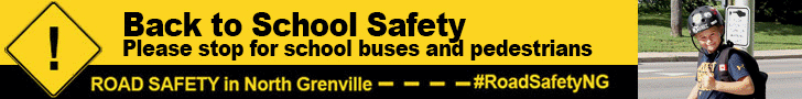
As students begin another school year, the North Grenville Road Safety Committee is reminding everyone to be safe as they travel to and from school – whether it be by active travel (walk or bike), or by car or bus.
Motorists should be prepared to slow down and stop for children and school buses. As more kids will be walking and riding their bikes to school, motorists should be watching for children, particularly at road crossings.
School Zones and Community Safety Zones: Slowdown in school zones and be extra cautious. Motorists should watch for Community Safety Zones, where fines are doubled if caught speeding. Community Safety Zones are clearly marked with road signs and are located along Country Road 44, Concession Road and Clothier Street.
Safe Walking Route Maps: With more parents choosing to drive their children to school, drop off and pick up may be more hectic. The Leeds, Grenville and Lanark Public Health Unit along with their active school travel partners developed safe walking route maps families can use. If it isn’t feasible to walk the entire way, consider parking a block or two away from the school and walk the rest of the way. This will help relieve traffic and is a great way to be active.
Community wide speed limit reduction in Kemptville: A reminder that the Municipality of North Grenville has implemented a community wide 40 km/h speed limit in the urban core of Kemptville. The affected areas begin South of County Road 43 to Concession Road, Somerville Road and Hurd St to the West, as well as Van Buren to Bridge St. and Wellington Road to the East. The Tempo Subdivision on dePencier Drive and the eQuinelle Subdivision off of County Road 44 are also included.
The Road Safety public awareness campaign aims to promote safe driving behaviours and make roads in North Grenville safer for all users.
The North Grenville Road Safety Campaign Committee is comprised of the Municipality of North Grenville, the Leeds, Grenville and Lanark District Health Unit, the Grenville County Ontario Provincial Police, and the United Counties of Leeds and Grenville.
Visit our website for more details on the campaign including safe route school maps:www.northgrenville.ca/roadsafety.
Safe Route School Maps are available on our website for the following schools:
- South Branch/Notre Dame / Rivière-Rideau
- Holy Cross Catholic School
- Kemptville Public School
Community Safety Zone vs School Zones
School Zone – A School Zone is an areas within 150 metres on either side of a school which has a lower speed limit during school hours.
Community Safety Zone – A Community Safety Zone is an area where public safety is of special concern, such as areas around schools. Fines are doubled if caught speeding in the area.
Schools in North Grenville and the safety zone designation:
- Oxford on the Rideau Public School (50 Water St.) – School Zone with speed limit of 50 km/hr
- Kemptville Public School (County Road 44) – Community Safety Zone with speed limit of 60 km/hr
- South Branch Public School/ Rivière-Rideau/Académie Notre Dame (Concession Road) – Community Safety Zone with speed limit of 40 km/hr
- North Grenville District High School (Concession Road) – Community Safety Zone with speed limit of 40 km/hr
- Holy Cross Catholic School (Clothier Street) – Community Safety Zone with speed limit of 40 km/hr
- St. Mike’s High School (County Road 43) – School zone with speed limit that changes during school hours from 60 km/hr to 40 km/hr.


