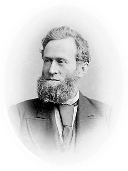
For the historian, a document will come along that provides a unique opportunity to look at a particular moment in the past and a snapshot of a society at a particular point in time become visible. Thanks to a man named Samuel Casey Wood, such a snapshot of North Grenville in 1880 is available.
Samuel Wood was the Commissioner of Agriculture for the Province of Ontario from 1875 to 1883, as well as being Provincial Secretary. In his Annual report to the Provincial Assembly in 1879, he suggested that a commission be established “to inquire into the agricultural resources of the Province of Ontario, the progress and conditions of Agriculture therein, and matters connected therewith.” An Order-in-Council was passed on April 3, 1880, and the Commission got to work compiling an amazing set of statistics on the state of agriculture in each of Ontario’s counties. Questionnaires and circulars were mailed out to municipal offices requesting statistical data, and open hearings were held across the province in order that the committee might gather views and opinions. The commissioners also obtained evidence from the other provinces, the United States and Great Britain.
The final Report, presented in 1881 gives that snapshot of the state of affairs in Grenville County in 1880, and it makes for fascinating reading. At the time, North Grenville was still separated into the Townships of Oxford-on-Rideau and South Gower, as well as the Village of Kemptville. The Report shows that Oxford had a population of 3,333, South Gower had just 883 residents. Wolford Township had almost 2,000 inhabitants, although residents of that township will be upset to note that the Commission referred to it as “Watford”, not Wolford.
It is interesting to note that, almost 80 years after the first settlers arrived, Oxford had only half of its land cleared for agriculture, although it was believed that about half of the uncleared land would be suitable for cultivation, if cleared. South Gower was even less cultivated, with only 3,629 of its 22,000 acres cleared, again with half of the uncleared land suitable for cultivation. Only half of the cleared land in South Gower was free of tree stumps. It was calculated that land could be cleared of stumps at an average rate of 1 acre per year.
Perhaps it is a surprise to note that Oxford had more sheep than cows, almost a thousand horses, and 680 hogs. South Gower had more cows than sheep.
The Commissioners asked what market facilities the townships enjoyed, and Kemptville is listed by both Oxford and South Gower as the nearest market. For South Gower, the Village was just half a mile away, and Oxford noted that Kemptville itself was just half a mile from the railroad, meaning the station at Bedell.
As for local industries, South Gower reported that they had “No industries excepting one cheese factory, situated at a place called Heckston”. Oxford was in a slightly better position, being able to boast of two cheese factories, “located at Oxford mills and Bishop’s mills”. Sadly, Wolford’s answer to what local industries they enjoyed was simply: “None”.
Another interesting statistic from the Report is that both South Gower and Oxford remained well-covered with trees. Oxford had 20,000 acres under trees, about one-third of the land, made up mainly of ash, elm, cedar, beech, maple and tamarack, which is described as good for “fencing and building purposes”. South Gower had about 8,000 acres of trees, much the same kind as Oxford, which were also used primarily for “firewood, fencing, and sawed into lumber”.
Of the cultivated land, Oxford’s main crop was hay (8,000 acres), oats (7,000 acres), and rye (5,000 acres). There were 1,000 acres each of potatoes, buckwheat, and peas. The main crops in South Gower were oats (2,500 acres), spring wheat and barley (2,00 acres each) and hay (1,500 acres). Neither the farmers in Oxford nor South Gower used “salt, superphosphate, lime, plaster, or other artificial fertilizers” on their land.
In both townships, 75% of farmers were using “improved farm machinery, reapers, mowers, seed drills, and sulky rakes”, whatever they were. The farms were progressive, it seems, and the farmers’ homes were 60% brick or stone in Oxford. However, in South Gower, 92% of the houses were still log or “inferior frame” in construction.
It is good to remember that, behind the dry statistics, lies innumerable stories of real people; men and women and children who lived and worked on the land we now share. With no electricity, no tv or internet, and very few modern luxuries, they were, at the time of the Commission Report, turning a forest into farms, building roads and communities that became the Municipality of North Grenville. Snapshots can tell many stories.


